You are here
Back to topNational Geographic Colorado Wall Map - Laminated (40.5 X 30.25 In) (National Geographic Reference Map) (Not Folded)
(This book cannot be returned.)
Description
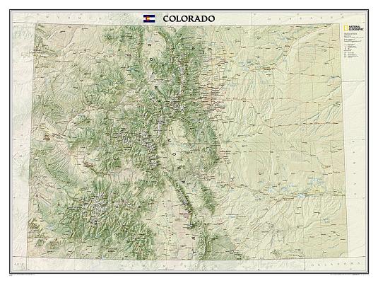
The spectacular topography of the Centennial State is expertly rendered on National Geographic's wall map of Colorado. Part of the growing series of State Wall Maps, this map depicts Colorado's diverse terrain and vegetation in remarkable detail. Mountain ranges, prominent peaks, major lakes, rivers, and reservoirs, and other geographic features are highlighted. In addition to hundreds of place names, this map includes the precise locations of cities, major roadways and railways, airports, military installations, federal and state parks, and protected areas. Prominent recreation features such as the Colorado Trail, Continental Divide Trail, and ski areas are also noted. This striking map would be an attractive addition to any study or office.
The map is encapsulated in heavy-duty 1.6 mil laminate which makes the paper much more durable and resistant to the swelling and shrinking caused by changes in humidity. Laminated maps can be framed without the need for glass, so the frames can be much lighter and less expensive.
Map Scale = 1:705,686Sheet Size = 40.5" x 30.25"